A governance layer for secure spatial data control

Unify, govern and secure spatial data assets across defence, government, and enterprise environments, while maintaining fine-grained access control and full auditability.

A single system for governed spatial data assets

Replace siloed datasets and inconsistent access controls with a unified internal archive.

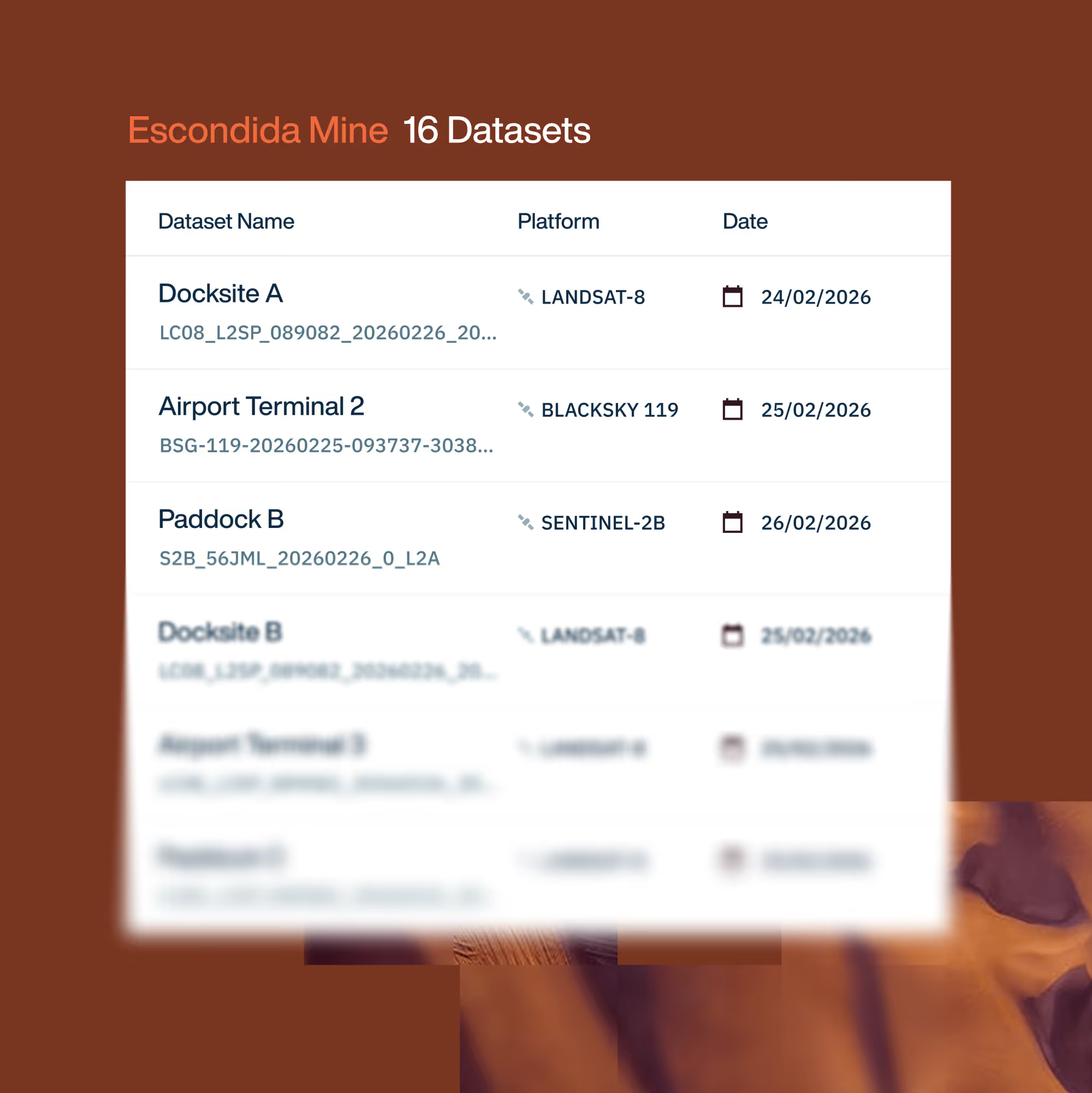
Unified internal archive

Build a single repository for satellite imagery, derived products, and third-party datasets.

Cross-organisation discoverability

Make authorised datasets queryable across teams without duplicating data.

Dataset fusion and layering

Combine assets from multiple sources into intelligence-ready collections.

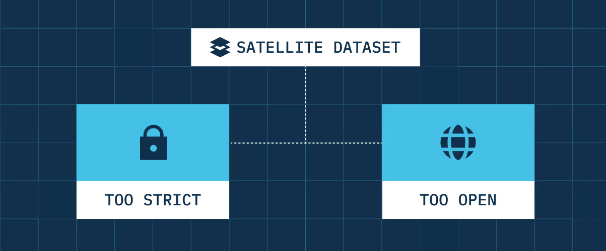
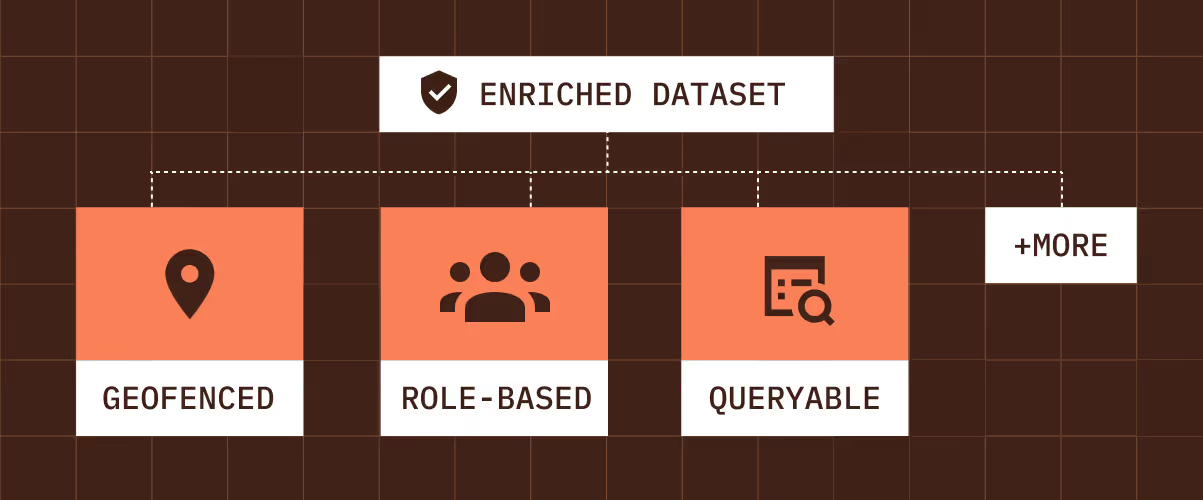
Fine-grained access control

Control visibility and usage down to individual users, roles, and APIs.

Secure handling of sensitive data

Manage commercial and classified datasets within controlled environments.

Full auditability

Track data access, usage, and policy enforcement across the organisation.

How it works in practice

Turn  data holdings into governed infrastructure.

Consolidate

Spatial data assets – including imagery, derived products, and third-party datasets – are unified under a single internal archive.

Govern

Access controls are enforced at user, role, and API level, ensuring only authorised entities can view or use sensitive datasets.

Fuse

Datasets from multiple sources are layered and combined into curated collections that support analysis and operational decision-making.

Audit

All access and usage events are recorded, enabling traceability, compliance and policy enforcement.

Built with your requirements in mind

✓ Enterprise grade security
✓ Audit ready by design
✓ API first architecture
✓ Modular by design
✓ Vendor neutral infrastructure
✓ Public or private cloud
✓ Standards based interoperability
✓ Granular access control
✓ Licensing aware
✓ Enterprise grade security
✓ Audit ready by design
✓ API first architecture
✓ Modular by design
✓ Vendor neutral infrastructure
✓ Public or private cloud
✓ Standards based interoperability
✓ Granular access control
✓ Licensing aware

Built for control and visibility

As spatial data volumes grow, governance is hard to retrofit.

Advanced Data Management embeds control, visibility and policy enforcement directly into how spatial data is stored, accessed, and shared.

Eliminate data silos

Unify spatial assets under a common management layer.

Controlled collaboration

Share collections securely across teams and programs.

Policy enforcement by default

Access rules and entitlements embedded at infrastructure level.

Compliance-ready operations

Support defence and government audit requirements.

Live and maintained in weeks, not months

Adopt governed data management without rebuilding existing storage infrastructure.

Build it yourself

Average 9 months

Month 0–3

Design internal archive and access model.

Month 3–6

Implement custom access controls and sharing rules.

Month 6–9+

Integrate governance into production systems.
Build audit logging, policy enforcement, and licensing traceability across workflows.

Ongoing Maintenance

Maintain policy enforcement and audit tracking. Update controls as teams, suppliers and regulations change.

High internal cost. Long time to value. Permanent operational burden.

With Advanced Data Management

Average 3 weeks

Week 0-3

Deploy unified archive and governance layer.

Live with Light Maintenance

Operate through auditable, policy-driven data management.

Week 3+

Integrate existing datasets under consistent access controls.

Live in weeks. No internal build. No long-term maintenance load.

Let’s talk about how you run EO today

Most conversations start with understanding your current systems, workflows and constraints to see how Arlula can empower your team.