Meet Geostack
One infrastructure layer, built to scale with your operations
Geostack is Arlula’s modular infrastructure layer for teams who rely on EO data every day and need it to move, scale, and integrate without manual intervention.

Built for teams running critical Earth Observation
Geostack is designed for organisations that already rely on EO data in production and need their systems to keep performing as volume, urgency and complexity increase.

One layer, made modular by design.
Geostack is built as a set of independent modules on a shared infrastructure layer.
Deploy what you need
Each module solves a specific operational problem and can run on its own.
Integrate with what you have
Geostack connects to existing systems via APIs. No forced migration.
Scale as requirements grow
Modules can be combined into larger workflows over time.
Teams typically start with the part of their workflow that creates the most friction. Additional modules can be added as requirements grow.
Book a call
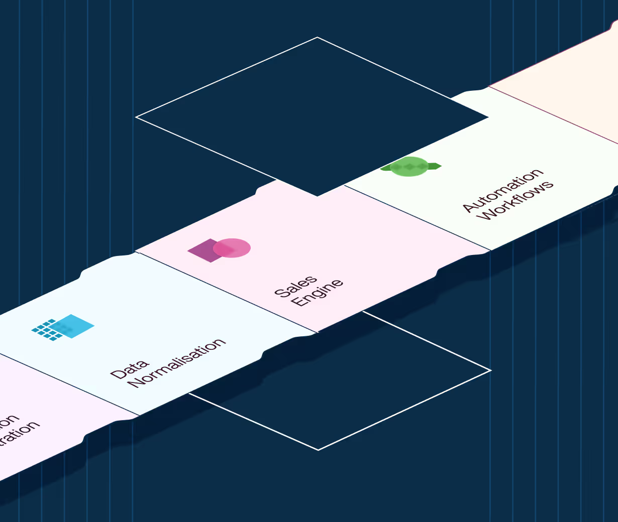
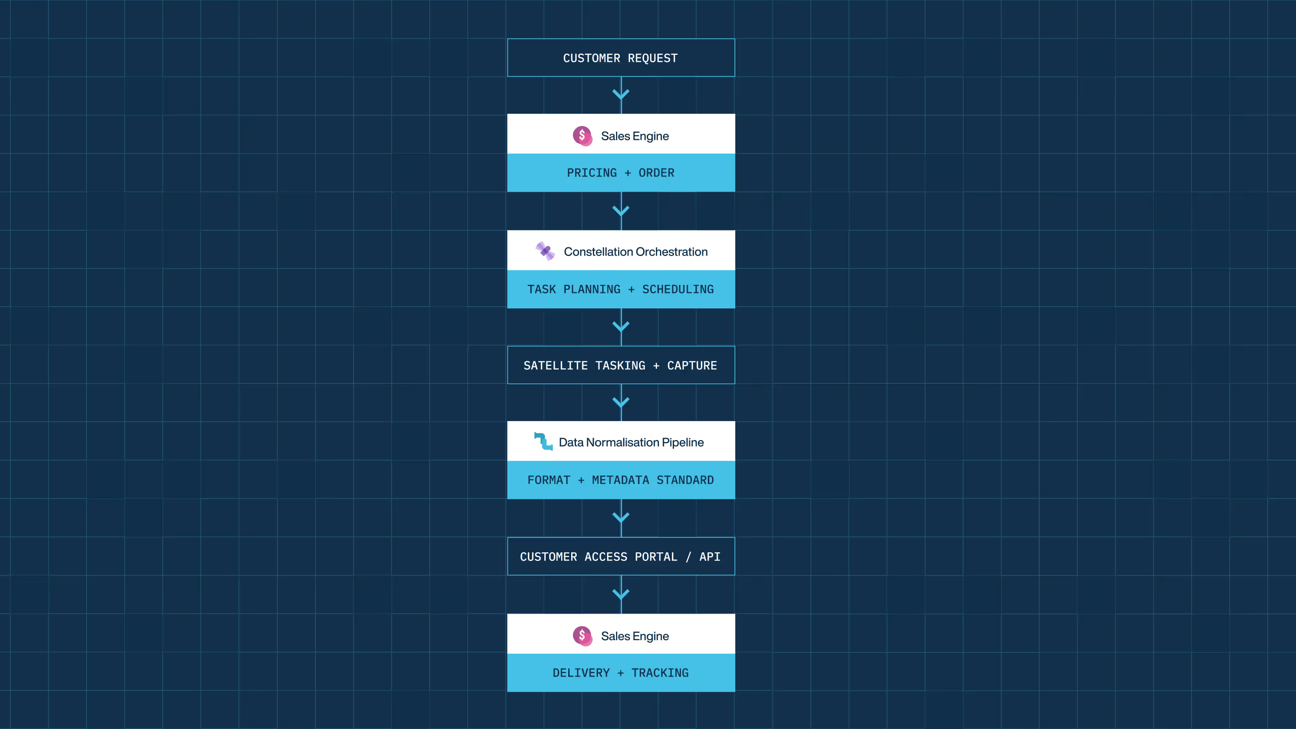
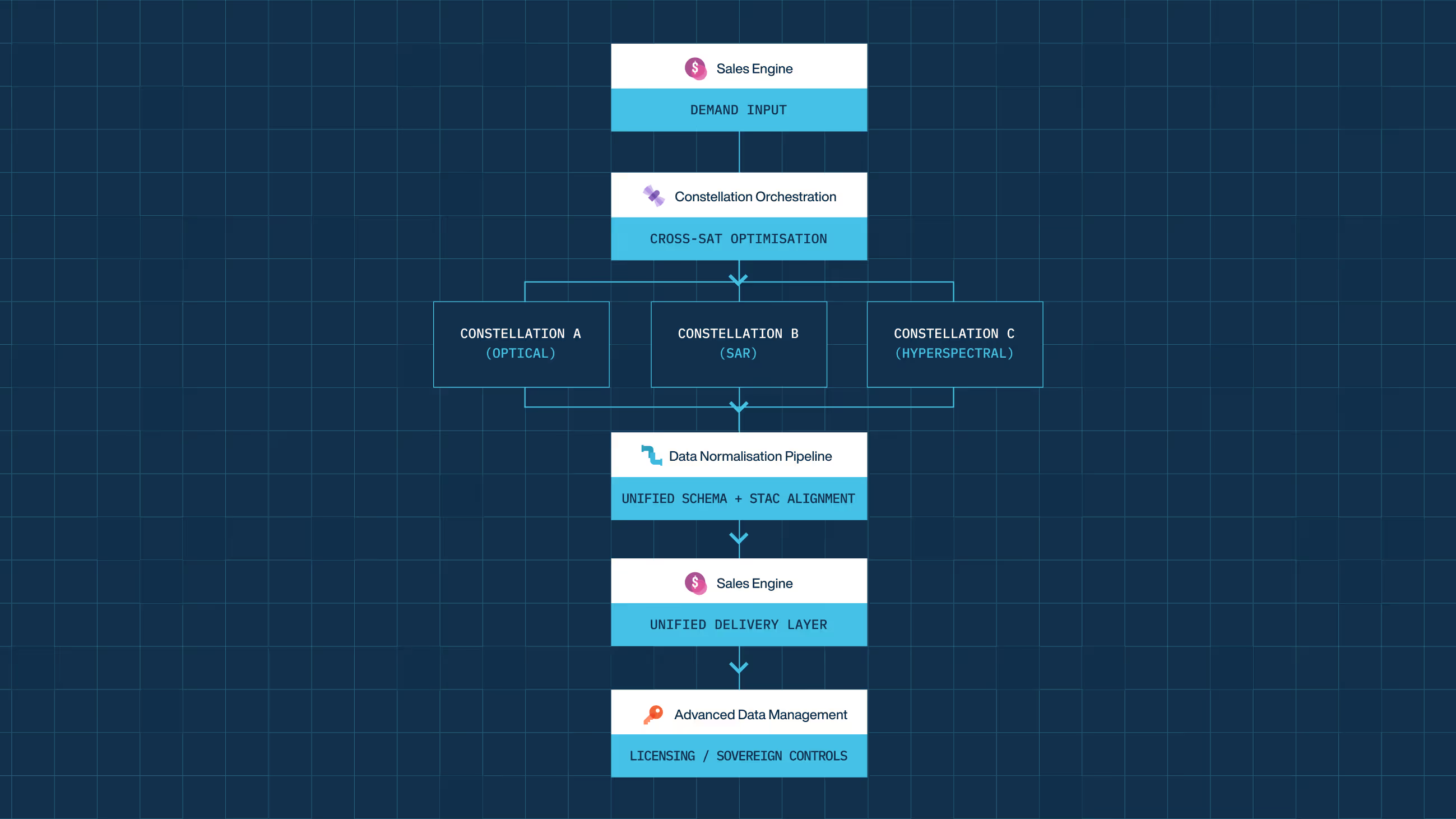
Sales Engine
Standardises pricing, ordering, and transactions for EO data. Used to reduce manual commercial processes.
Explore
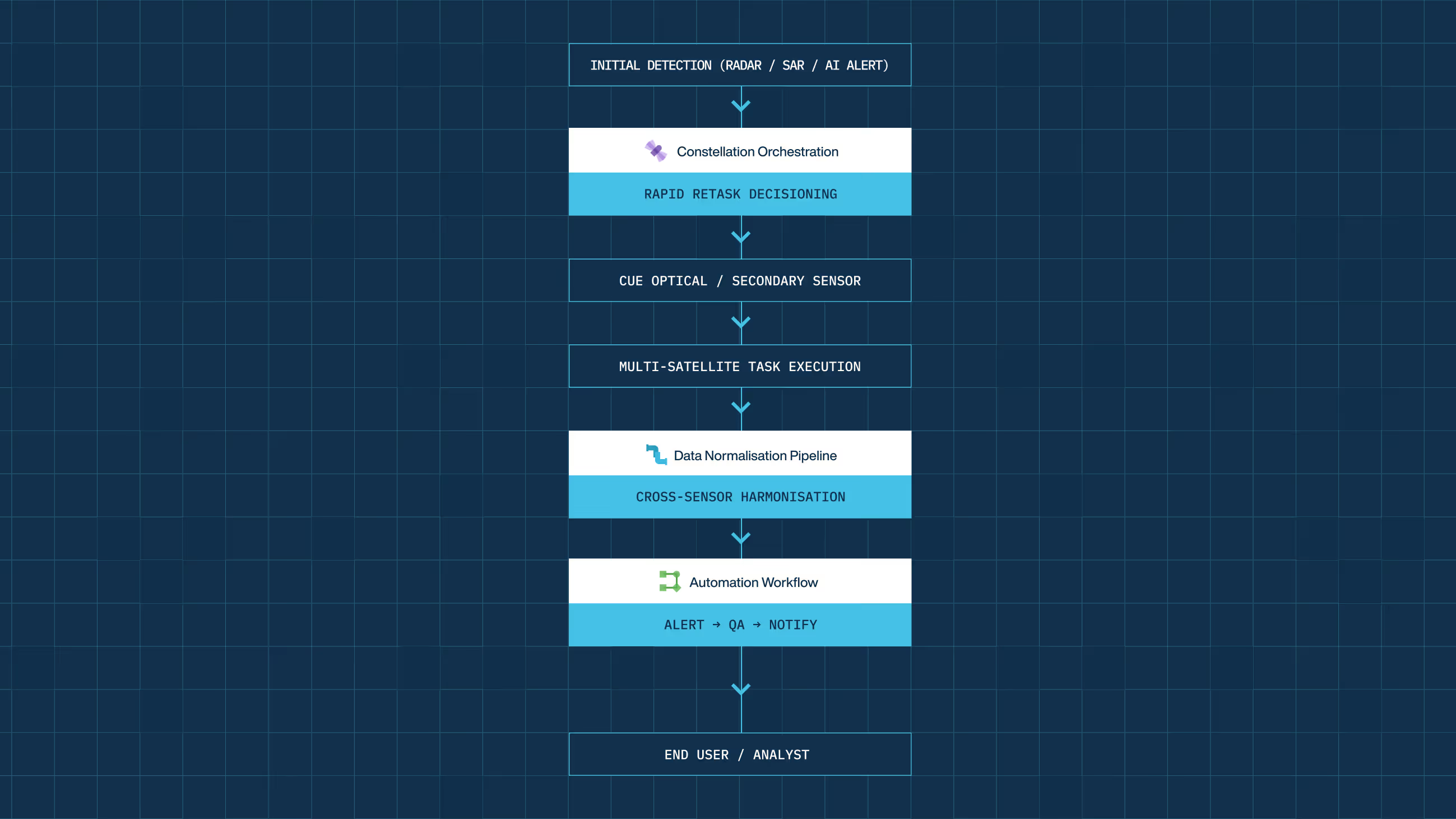
Data Normalisation Pipeline
Automatically standardises EO data formats and metadata. Used to ensure data is ready for downstream systems immediately.
Explore
Advanced Data Management
Manages access control, licensing, and auditability at scale. Used in regulated or multi-team environments.
Explore
Constellation Orchestration
Coordinates tasking and execution across satellite constellations. Used by operators managing multiple satellites and constraints.
Explore
Automation Workflows
Orchestrates end-to-end EO workflows without custom scripts. Used to build repeatable, production workflows.
Explore
Fulfilment Engine
Automates ordering, tracking and delivery of EO data. Used to ensure predictable delivery without manual follow-up.
Explore
Designed to slot in, then scale with you
Speak to our teamUnderstand your environment
Arlula starts by mapping existing EO workflows, systems, operators, and constraints.
Integrate, don’t replace
Modules are introduced into current infrastructure via APIs and automation, with no forced migration.
Expand as needed
Teams extend usage gradually as operational needs evolve.
Organised by operational layer
Geostack is built as a set of independent modules on a shared infrastructure layer.

Workflows
Coordinates how imagery is planned, requested, and executed across operators and systems.
Automation Workflows
Developer toolkit for automating GEOINT workflows.
Constellation Orchestration
ML-based scheduling system for satellite operators.

Data
Standardises, secures, and governs imagery once it’s collected.
Data Normalisation Pipeline
Turns unstructured multi-sensor imagery into analysis-ready STAC archives.
Advanced Data Management
Handles access control, encryption, and audit so data can move securely across teams.

Access
Enables imagery to be ordered, delivered, and commercialised at scale.
Fulfilment Engine
Unified ordering and delivery pipeline for imagery and tasking.
Sales Engine
White-label storefront for packaging and selling EO products.
Common ways teams use Geostack
These examples show how Geostack modules slot into real organisational workflows, like yours.
Built for your automation and AI transition
Geostack is designed for a near future where your EO workflows are increasingly automated and AI-driven.
Infrastructure, not scripts
Logic lives in the platform, not in people or brittle, one-off automation.
Automation-first workflows
Workflows are designed to run without manual coordination as volume and complexity increase.
AI-ready by design
AI can be introduced where it adds value without reworking core systems.
Governed at scale
Automation and AI can operate within access controls, permissions and audit rules.
Designed to integrate with existing infrastructure
Geostack integrates with existing clouds, data platforms, analytics environments, and internal tools via APIs
— without forcing a rewrite or vendor lock-in.
Cloud environments
Object storage
Computer services
Analytics Environments
Compute Infrastructure
Data Lake
Data Platforms
Cloud environments
Object storage
Computer services
Analytics Environments
Compute Infrastructure
Data Lake
Data Platforms
Analytics tools
Processing pipelines
Visualisation layers
Customer endpoints
Data Warehouse
Enterprise Data Platforms
Internal Data Platforms
Analytics tools
Processing pipelines
Visualisation layers
Customer endpoints
Data Warehouse
Enterprise Data Platforms
Internal Data Platforms
Mission systems
Internal dashboards
Decision support tools
Secure environments
Partner Networks
Partner Systems
Public Private Cloud
Mission systems
Internal dashboards
Decision support tools
Secure environments
Partner Networks
Partner Systems
Public Private Cloud
Let’s talk about how you run EO today
Most conversations start with understanding your current systems, workflows and constraints to see how Arlula can empower your team.