Satellite imagery helps identify potential billion dollar construction oversight.
Planet Earth is described as a rocky planet with a solid crusty surface. For the people who inhabit it, some of its most striking features consist of tall mountain ranges, deep canyons and vast coastlines. As we view these seemingly rocky, solid features, It is easy for many parts of the world to forget that the Earth is, in fact, alive and active with constant movement. The tectonic surface we stand on moves around 3 to 5 cm a year, and at the equator, the earth spins at around 1609km/h. In addition to this, coastal erosion, landslides, natural disasters, and volcanic eruptions all contribute to movement and a forever changing surface that we inhabit as guests on this planet.
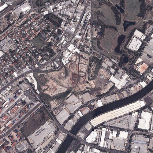
Satellite Imagery time-lapse of construction at the WestConnex St Peters Interchange.
As we continue to inhabit and expand the built environment we are increasingly subject to the movement of soil and earth which must be accounted for in construction. By not doing this, we expose construction projects to the risk of damage caused by the natural movements of the Earth’s surface.
One of the largest current construction projects in Australia is Westconnex. Westconnex is a $16 billion AUD, 33km motorway tunnelling project that was designed to keep up with Sydney’s growing population. The project is predicted to finish in 2023, however, the stress between the Earth and Westconnex has already begun. Many residents across several Sydney suburbs located above the WestConnex tunnelling project have reported subtle but notable damage to their properties, such as small cracks and jamming doors.
Due to the scale of the tunnelling, the only practical way to scale and accurately measure the impact it has had on the hundreds of thousands of homes across the city was to use satellite radar technology.

Krish Patel, Sat-Scan CEO saw an opportunity to utilise satellite technology to measure and monitor issues caused by large scale construction projects such as Westconnex. It was no coincidence that multiple residents above the WestConnex tunnelling all experienced building damage at the same time. To make matters worse for residents, the government weren’t willing to take responsibility for the damage to their homes. Sat-Scan was able to utilise satellite radar data to demonstrate that WestConnex tunnelling did cause measurable soil movement and significant damage to residential properties in surrounding areas.
Unfortunately until very recently, satellite imaging technology has been incredibly difficult to access. The high cost of satellite imagery along with the technical and legal hurdles associated with procuring it, has meant that it’s been difficult to utilise for monitoring critical infrastructure projects such as the Westconnex.
Sydney-based startup Arlula was able to support Sat-Scan in accessing the critical satellite data needed for its assessment process. By leveraging the Arlula API platform and satellite imaging partner network, Sat-Scan was able to easily capture 900sqkm of new radar imagery per month over Sydney. This service was critical in assessing the impact and scale of damage to properties across the city.
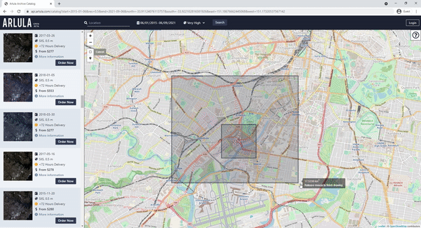
Try the Arlula catalogue browser now at https://api.arlula.com/catalog
Sat-Scan’s Earth movement monitoring service has since been purchased by local governments in Sydney to help residents fight back against the large corporations that have caused this damage in the first place. By combining satellite imaging technology with data analytics tools Sat-Scan was able to empower local residents and help save their properties from destruction.
There is an argument to be made for Government agencies undergoing multi-billion dollar construction projects to collaborate with innovative startups like Sat-Scan. By doing so, they will be able to harness new technologies that help limit or prevent damage to the Earth and the population that occupies it.
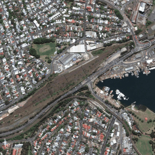
Satellite Imagery time-lapse of construction at the WestConnex Rozelle Interchange.
The next step to adopting this technology is awareness and education. There are so many unique ways satellite technology can be harnessed and the ability to monitor the earth will assist us in making more responsible choices. Arlula continues to improve access to satellite data that helps formulate these incredibly valuable insights.
To follow Sat-Scan’s journey you can visit them on their website, https://www.sat-scan.com/. And to easily access satellite imagery for your own project you can start by visiting https://api.arlula.com/catalog.