Geostack Enterprise Solutions

Streamlined Data and Team Management

Enterprise users face significant challenges when accessing and managing satellite imagery at scale, chiefly due to the data’s unique properties, operational requirements, and integration complexities. These problems can significantly affect the ability to gain timely, actionable insights and realize the promised operational efficiencies. Geostack is essential for overcoming these challenges and unlocking the full value of large-scale satellite imagery.

Secure Geospatial Data Management and Sharing

Optimal Data Acquisition
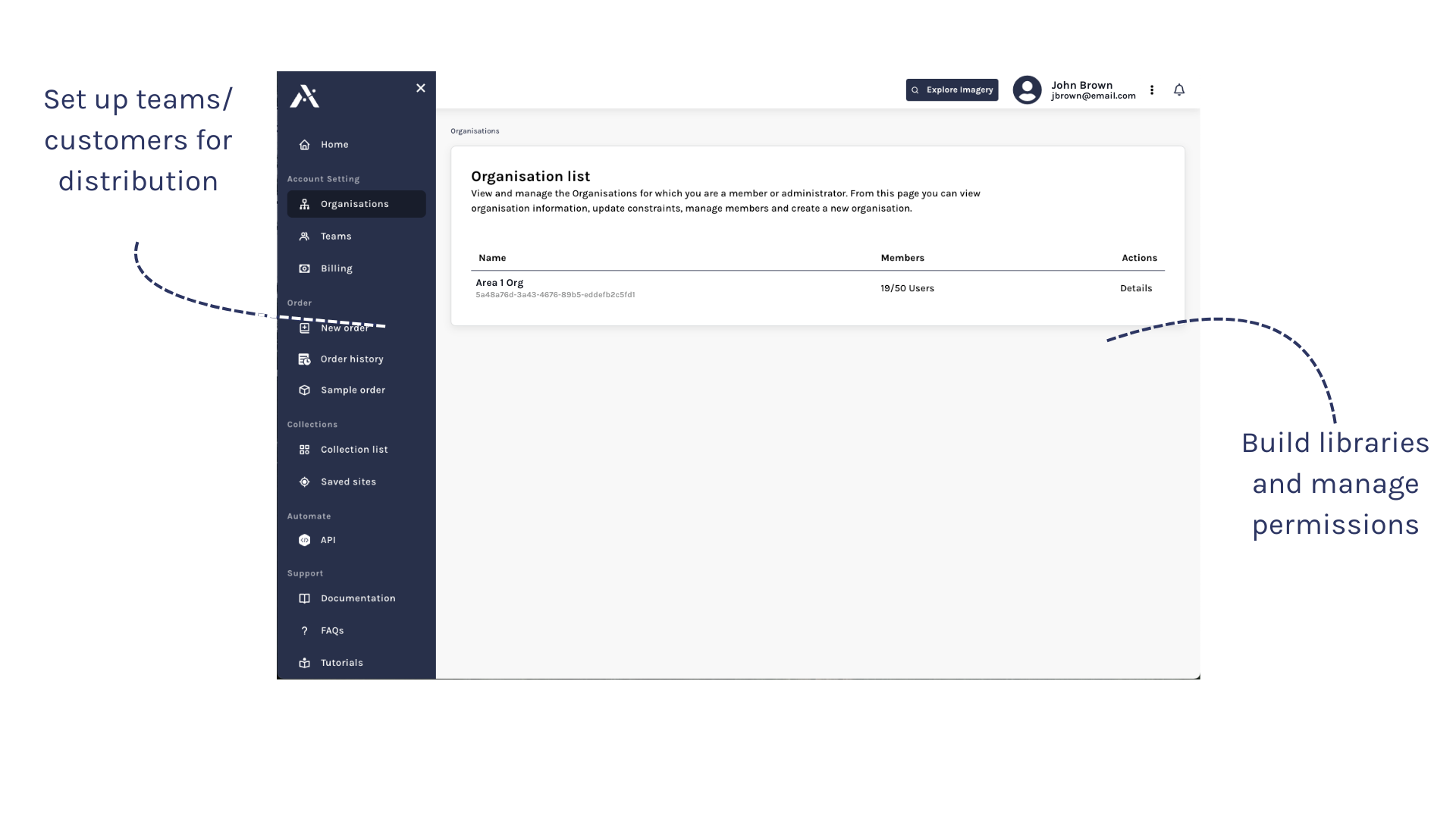
  • Better oversight of your data allows for more effective utilization and sharing within your team and broader organization

Manage Permissions

  • Administrator controls enhance management of individual member and whole of organization permissions.

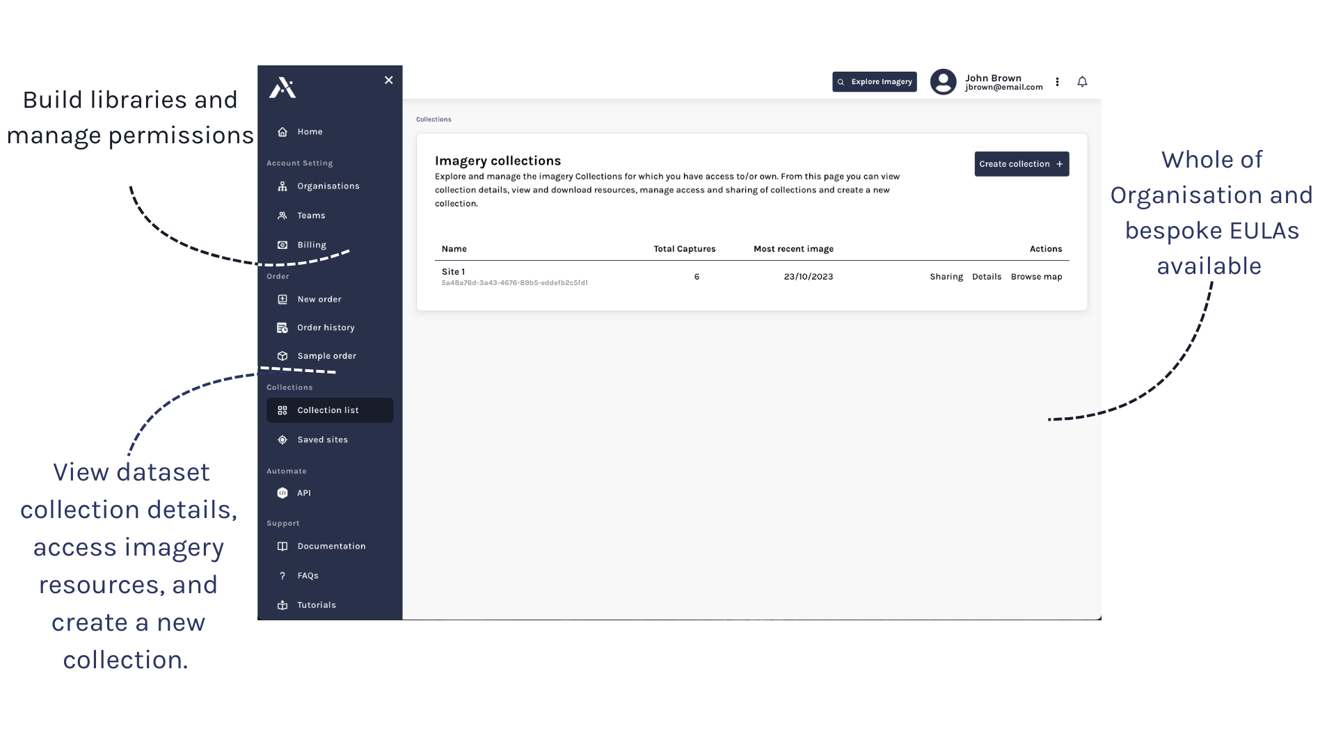
Organize Data In Collections

  • Collections provide a streamlined process to visualize and share satellite datasets within your team and other departments.

Secure and Efficient Delivery

  • Cloud-based infrastructure for fast, secure, and straightforward delivery of geospatial data to your team.

Why Geostack for Enterprise?

Arlula’s Organization and Collections features enable scaled users to easily and efficiently manage their entire team and large amounts of satellite data all within one platform.

Manage

Control department and team permissions and easily manage licensing terms from different vendors through advanced organizational controls and user management system.

Reliable

Depend on a proven platform with robust capabilities.

Collaborate

Geostack is a central access point to all of your organization’s drone, aerial and satellite data in one platform.

Scale

Easily scale your operations as your business grows.

Transform your capabilities with Business solutions to empower your critical decisions. Get started today!