Satellite Tasking Vs. Archive
Since its creation, satellite imagery has served as a crucial asset across diverse applications. Today, it continues to stand as a cornerstone resource for countless individuals and organisations, facilitating effortless exploration of Earth’s dynamic landscapes. Whether it’s monitoring environmental transformations or tracing the intricate choreography of weather patterns, satellite imagery remains indispensable for accessing invaluable insights. However, for many who are beginning to use satellite imagery, deciding between tasking a satellite image or accessing one through a satellite archive can be tough. So what is the difference, and how do you decide which one is right for you? Here will outline what both tasking and archive are, how they are different as well as outlining how to find which one is right for you.

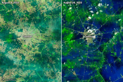
Image captured in Pakistan by Landsat 8 – OLI, August 4-28 in 2022.
What is Tasking?
Satellite tasking is a revolutionary tool for Earth Observation imagery, enabling one to easily request and schedule future satellite imagery captures tailored to your specific project needs.
When you task a satellite image, you are essentially requesting that the satellite take a new picture of a specific area at a specific time. This gives you a lot of flexibility and customisation. You can specify the area of interest (AOI), the time of day, and the resolution of the imagery. This can be important for getting the data you need for your specific application. Many people chose to task for a variety of reasons, such as;
- Monitoring environmental conditions: Satellite imagery can be used to measure changes in land cover, water resources, and vegetation. This information can be used to track the effects of climate change, monitor deforestation, and identify sources of pollution.
- Disaster management strategy: By having access to near real-time satellite imagery, emergency response professionals gain critical insight into the current changes and effects of said disaster. This allows for better evaluation and response plans.
- Urban planning and development: Satellite imagery aids city planners in analysing population growth, infrastructure needs, and land use patterns. This information is crucial for making informed decisions about zoning, transportation, and resource allocation in rapidly growing urban areas.


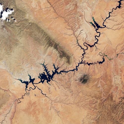
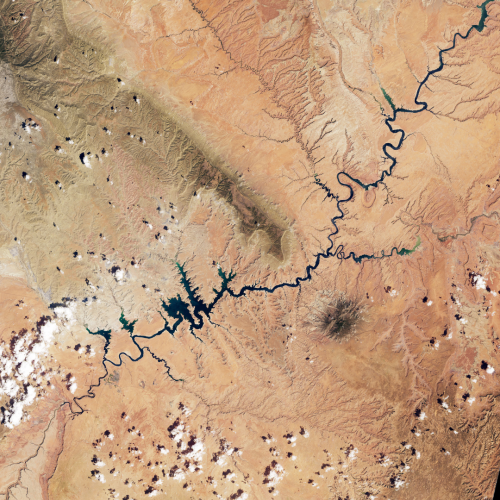
Image of Lake Powell, Utah, United States. Left side captured by Landsat 8 – OLI, 2017. Right side captured by Landsat 9 – OLI-2, 2022
What is Archive?
Satellite archive is a collection of historical satellite imagery that has already been collected. Many businesses, academics and even individuals use archive satellite imagery for a variety of purposes.
These are just a few of them:
- Improving sustainability: High-resolution satellite imagery provides crucial insight into how the landscape has changed in previous years. Many environmental organisations utilise satellite imagery to optimise resources allocation and minimise environmental impact
- Agriculture: Agriculture land is massive, taking up almost half (44%) of global land surface. By using satellite imagery, many farmers can vastly improve their monitoring capabilities and compare decades of data collected via the archive including soil moisture, pest control and yields.
By utilising platforms like Arlula, which enables you to access decades-long archives of high-quality satellite imagery, individuals and businesses can track environmental conditions, identify emerging trends, and further optimise their operations for maximum efficiency.
How are they different?
The biggest difference between tasking and archive is the process. With satellite tasking, one has to schedule their new imagery to be captured by selecting their desired area of interest and time. Whereas archive provides a library of high resolution satellite imagery that has been captured in the past.
Which one is right for you?
The best option for you will depend on your specific needs. If you need high-resolution, accurate imagery that is up-to-date, then you should consider satellite tasking. Additionally, satellite tasking enables further customisation. However, if you are looking for a satellite imagery that is not time-sensitive or captured in the past, then a satellite archive may be a better choice.
Want to keep up-to-date?
Follow us on social media or sign up to our newsletter to keep up to date with new product releases and case studies.


