3 Ways Satellite Imagery Can Empower the Rail Industry
In July 2023, a passenger train in Slovenia derailed. The cause, rocks that had fallen and obstructed the tracks during a strong storm. Thankfully, no one was harmed, yet the line remained closed for repairs. To prevent such incidents from occurring, improved observation and monitoring of railways is essential. For these purposes, satellite imagery is a revolutionary asset to the rail industry.
Satellite imagery offers a unique perspective to gain insights and solve problems in rail corridor management, vegetation encroachment, and incident response. Arlula’s platform, with its global network of leading data suppliers and streamlined data management, empowers users to efficiently derive actionable insights at scale. Here, we will look at 3 ways satellite imagery can power your critical rail decisions anytime, anywhere along the tracks.

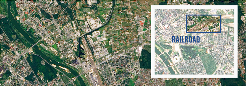
Warsaw, Poland captured by Landsat 8- OLI on 8 September, 2014.
1. Monitor Entire Rail Corridors
Satellite imagery is capable of capturing the expanse of long corridors frequently and in a single pass. This empowers rail network staff to efficiently monitor entire corridors from a single location. Not only does this lower labour expenses, incorporating on-demand satellite imagery improves safety of operations. Satellite imagery provides a complete picture of the corridors within a network, enhancing the ability to monitor even the most remote rail lines and reducing the need for costly and time consuming site visits.

2. Optimise Incident Response
Anticipating and planning for potential incidents is crucial for railway organisations. In the USA alone, the FRA ( Federal Railroad Administration), has recorded 742 incident reports for train derailments as of October in 2023. With high quality satellite imagery, damaged or obscured rail lines can be identified and appropriate action can be taken. Additionally, high-quality satellite imagery sensors can be utilised to detect ground deformation which is not easily visible to the naked eye, however, causes significant damage to railway tracks and even lead to derailment.
Leverage Arlula’s extensive library of archive satellite imagery alongside new on-demand tasking to monitor changes to track conditions, access points, stations, and surrounding areas. Arlula’s consolidated platform streamlines access to multiple satellite data sources, ensuring that rail access points and area conditions are consistently up to date. This enables a safe and timely response to incidents as they occur.

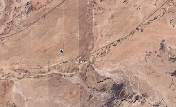
Rail line through Petrified National Park in Arizona, USA. Captured by Landsat 7 on 28 November, 2002.
3. Improve Corridor Maintenance
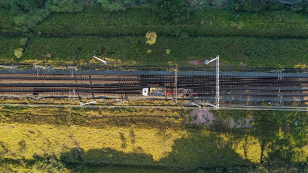
High resolution satellite imagery can be used to effectively identify intrusion and access points along corridors. Leveraging available spectral bands provides valuable vegetation data that enables early detection of encroaching vegetation along the corridor, enhancing the maintenance response. Optimise operational efficiency for routine and incident based maintenance with tailored licensing options suited for your imagery requirements.
Arlula for Rail
The incorporation of satellite imagery into rail operations is a cost-effective and efficient response to meet the needs of rail maintenance, corridor monitoring, and incident response.
To get the most value out of satellite imagery, an efficient and effective data management and procurement platform is essential. Geostack Terra is Arlula’s streamlined platform, empowering users to customise their experience to meet their data requirements. Ready to optimise your business with satellite imagery? Get started today with Arlula!
Want to keep up-to-date?
Follow us on social media or sign up to our newsletter to keep up to date with new product releases and case studies.


