
Building Better Cities: The Role of On-Demand Satellite Imagery in Urban Planning
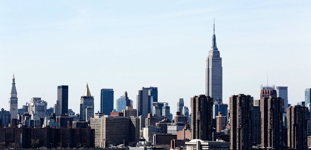
Since the early 2000s, Brisbane has transformed remarkably, evolving from a city with modest urban features to a dynamic metropolis. Fast-forward to 2023 and Brisbane has been noted as the fastest-growing city in Australia, with a growth rate of 2.3%. Brisbane is one of many areas with rapid urban growth. Australia alone is expected to reach a population growth of 29.5 million by 2029. As Australia rapidly expands, urban planning becomes pivotal to accommodate the expected booming population growth.
However, urban planning currently has many limitations, especially in conducting research in high-density areas. That’s where Satellite imagery comes in.
“Satellite imagery are our eyes in the sky, providing those insights and up-to-date information.”
— Dr. Lillian Pintea, VP of Conservation Science, Jane Goodall Institute
Satellite imagery offers a unique perspective to gain insights and solve problems in activity analysis, infrastructure planning, and regulation enforcement. Arlula’s platform has curated a global network of leading data suppliers and developers in combination with a consolidated data management platform, giving users the power to derive actionable insights at scale with greater efficiency. Below, we will explore 3 ways that satellite imagery can help create and maintain liveable cities.
1. Optimise Activity Analysis
One of the biggest challenges in developing urban planning and infrastructure is visualising the various activities in a given urban area. These include comprehending the patterns and interactions of human activities and considering future impacts, such as events, parades, festivals, or even emergencies. Thus, real-time data is needed to track and interpret these diverse activities of a given urban area.
By using an extensive archive of satellite imagery and on-demand tasking, one can identify high-growth zones and anticipate future growth trends. Furthermore, recurring satellite imagery through tasking enables one to continuously monitor changes in human behaviour, watershed patterns, and vegetation cover—leverage available bands to analyse urban behaviours.
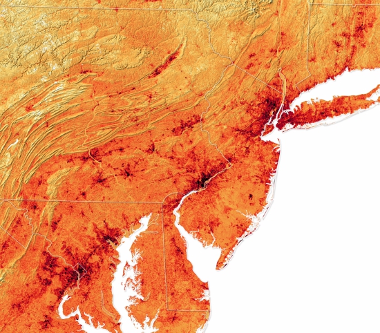 Temperature differences in major US cities (Philadelphia, PA and New York, NY) and surrounding areas ranging from 20C (yellow) to 45C (black). Captured by Landsat 8- OLI 21 June- 22 September 2019.
Additionally, satellite imagery helps mitigate the Urban Heat Island Effect by providing valuable insights into temperature variations across urban landscapes. This information allows urban planners to identify heat-prone areas and implement targeted strategies, such as incorporating green spaces, optimising building materials, and enhancing ventilation, to create more sustainable and comfortable urban environments.
2. Enforce Regulations
Monitoring is essential in urban development. It ensures planners understand the dynamics of various spatial and temporal indicators and improves the effective management of urban development.
Using satellite imagery, planners can efficiently monitor the activity in a given development site by scheduling recurring image captures with tasking. High-resolution satellite imagery provides a complete picture of up-to-date road networks and infrastructure within large areas of interest without physically returning to a site.
3. Improve Infrastructure Planning
Enhance site selection and preparation with new, tasked satellite imagery used in conjunction with other mapping and analysis softwares such as GIS. Together, these tools can be used to evaluate terrain, anticipate infrastructure maintenance, and address environmental impacts. Understanding how the natural landscape and existing structures impact areas of interest, will help to reduce the risk of damage during severe weather, decrease interference or obstruction, and minimise impacts on the native environment.
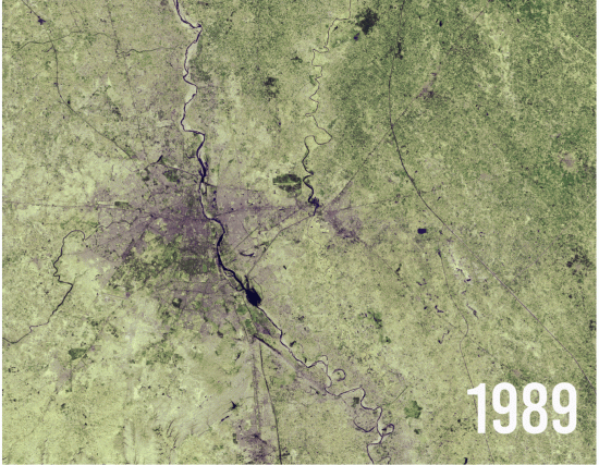
Urban growth of New Delhi, India. Captured by Landsat 5 on 5 December 1989 and Landsat 8 on 5 June 2018.
Urban Planning with Arlula
Satellite imagery can play a crucial role in addressing the challenges posed by rapid population growth in cities like Brisbane. By optimising activity analysis, simplifying regulation enforcement and improving the infrastructure planning process, satellite imagery is an invaluable tool. Arlula’s tasking platform provides streamlined procurement of new satellite imagery to empower informed decision making for a sustainable and liveable future.
FAQ’s
Want to keep up-to-date?
Follow us on social media or sign up to our newsletter to keep up to date with new product releases and case studies.


