
Satellites to the Rescue: Visualising and Responding to Nature’s Challenges
One of the many uses for satellite tasking is within the disaster response and management industry. Government organisations and emergency response professionals often use Earth Observation satellite imagery to evaluate natural disasters, create response plans, and develop techniques to reduce chances of a disaster occurring again and improve preparedness if it does. Here we will explore how high-quality satellite imagery can help to combat three common natural disasters.
Wildfire
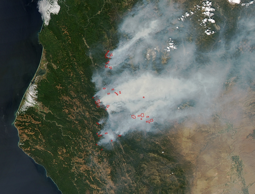
In Australia, and many other countries, bushfires and wildfires are a common seasonal problem. Satellite tasking helps firefighters to map affected areas as wildfires are happening and ensure that surrounding areas can be notified and evacuated in a timely manner. By providing a visual of fires as they burn, satellite imagery reduces the risks by helping officials to navigate the fires safely and effectively.
Captured by Aqua- MODIS on 5 August, 2015.
Flood
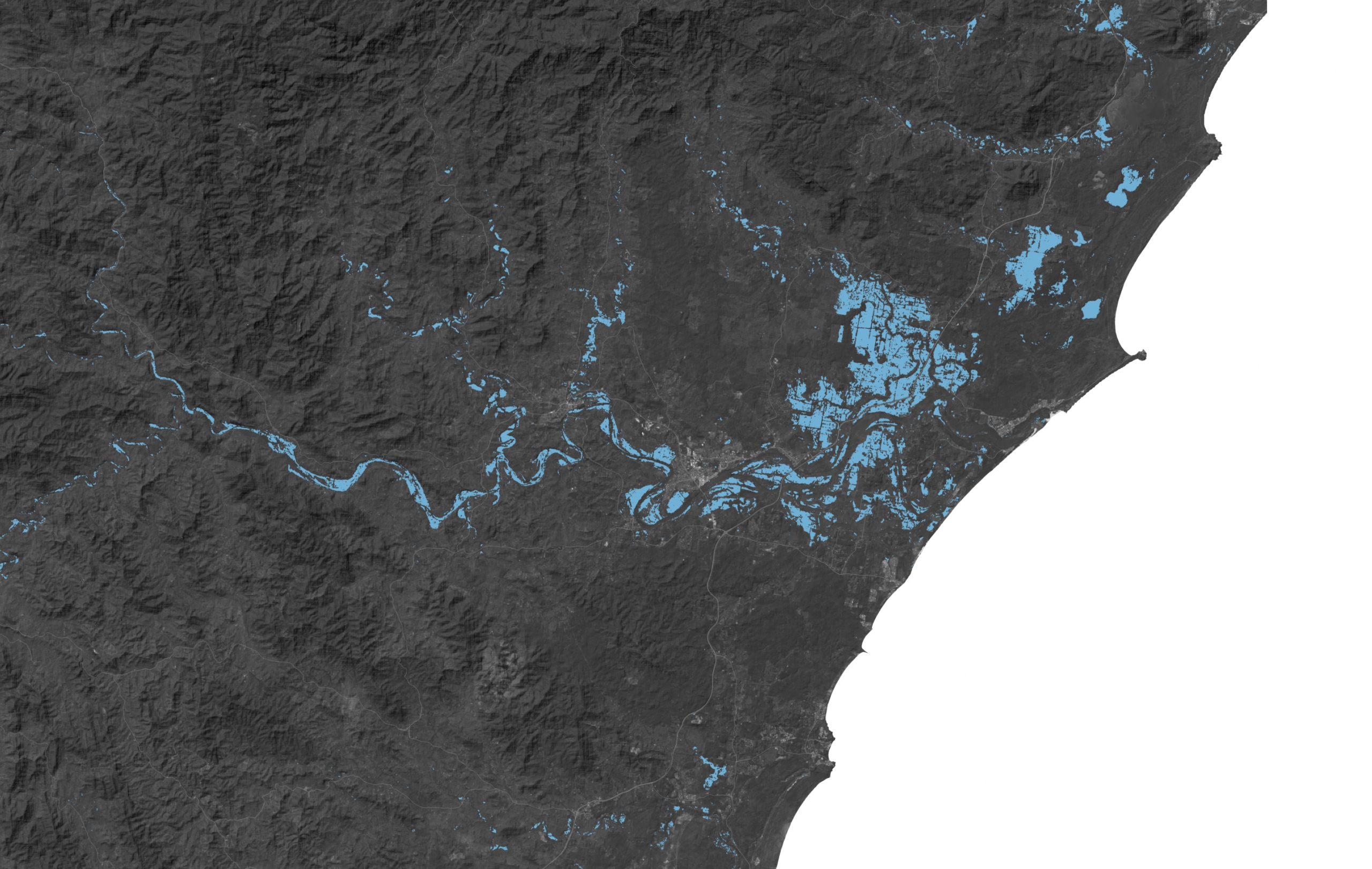
During rainy seasons and storms, cities often face the threat of flooding. High Quality satellite Imagery helps first responders with rescue efforts, allows homeowners to assess risk and damages to their property from any location, and can help governments with future mitigation efforts. Real time data received from satellite imagery can be used to track progress in flooded areas and the extent of damage, optimising relief efforts.
Captured by Copernicus Sentinel-1 on 20 March, 2021.
Drought
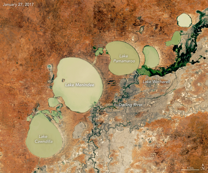
With a changing climate, drought is something that affects urban residents and agriculture professionals alike. Earth observation imagery can provide landowners and governments with information such as water levels in lakes or rivers, assess vegetation cover, and forecasting weather. Data collected from high quality satellite imagery can help to predict drought duration and severity, ultimately helping the communities affected to prepare and respond accordingly.
Captured by Landsat – 8 OLI 27 January, 2017 to 2 February, 2019.
In conclusion, the application of earth observation imagery in disaster response and management plays a crucial role in safeguarding communities and minimising the impact of natural disasters. With high quality satellite imagery, government organisations and emergency responders can enhance preparedness, response, and recovery efforts for wildfires, floods, drought, and many other disasters. Ready to harness the power of satellite imagery? Access the library of archive imagery or submit tasking requests for new imagery with the Arlula Catalog Browser.
Want to keep up-to-date?
Follow us on social media or sign up to our newsletter to keep up to date with new product releases and case studies.


